Top 3 trails for waterfall hike in hong kong
1. Hong Kong Island - Lugard Falls⭐
2. Lantau Island - Silvermine Waterfall⭐⭐
3. New Territories - Ng Tung Chai Waterfall⭐⭐⭐

Soaring summer temperature in Hong Kong exceeds 30 degrees. It can be too much hiking in this weather. What about routes with more shade and close to the water? You can stay cool without too much sun exposure. Decathlon recommends three routes of Hong Kong waterfall hike with different levels of difficulty - easy, medium and difficult, for your next outing this summer!
1. Hong Kong Island - Lugard Falls⭐
2. Lantau Island - Silvermine Waterfall⭐⭐
3. New Territories - Ng Tung Chai Waterfall⭐⭐⭐

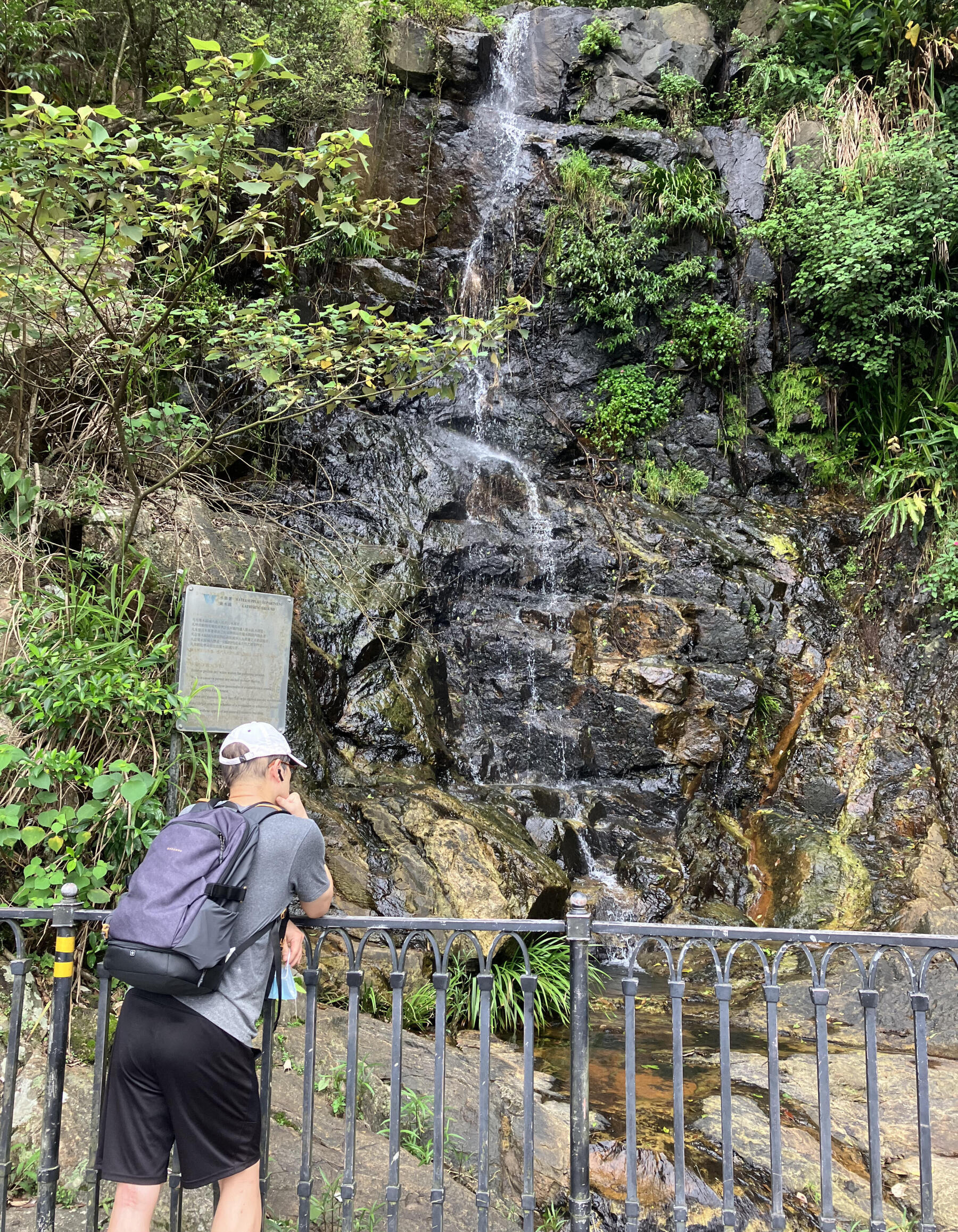
Lugard Road and Harlech Road in the peak area are easy and scenic routes for beginners. The no-steps surface makes it accessible to wheelchairs or strollers.You can also overlook the beautiful scenery of Victoria Harbour and the west of Hong Kong Island along the way. It is the perfect spot for sunset and night view.
Starting from The Peak Galleria, you can walk around the Peak either clockwise or counterclockwise, and it will take about two hours for the whole journey.
There is a steady stream of water most of the time, except for the chance that Lugard Falls will dry up in winter. Lugard Falls becomes even more spectacular after heavy rain as it will pour water onto the road.
The walk to the falls is very safe as the falls is behind a fence. Even so, you still need to pay attention to weather changes and do not cross the fence when hiking for safety.
Route:
Start at the entrance between The Peak Lookout and Peak Tower
Clockwise - Turn left into Harlech Road Fitness Trail and walk for one round
Anticlockwise - Turn right into Lugard Road and walk for one round
How to get there:
Minibus - Minibus no.1 from Central to The Peak Galleria
Bus - NWFB Bus no.15 from Central to The Peak Galleria
Length:
3.5km (elevation approximately 50m)
Duration:
Approximately 2 hours

Lantau Island is the largest island in Hong Kong. With the development of the new towns, it has become more accessible and convenient getting to the city. If you want to experience the old days, you can enjoy a stroll with a historical and natural touch on Tung Mui Ancient Trail.
Tung Mui Ancient Road was the main route between Tung Chung and Mui Wo in the past, with a total length of about 10 kilometers. It is mainly a concrete road. Starting from Tung Chung Station, you will pass by Pak Mong Village and see its watchtower, ancestral hall, walls and entrance gate that have become statutory monuments today. When you keep walking, you will reach the highest point of the ancient road - A Po Long.
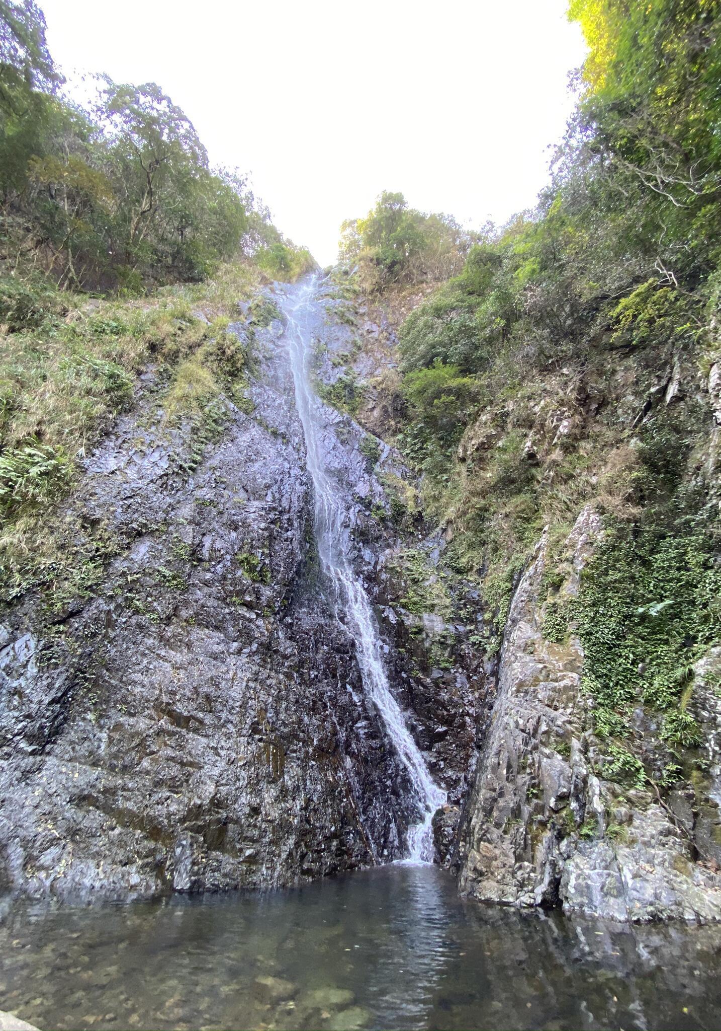
After a short rest at the A Po Long pavilion, you take an easy hike to Mui Wo. When you come to the mountainside, you will first see the Silvermine, where lead and silver were mined in Hong Kong in the past. Walk 5 minutes further and you will see Silvermine Falls. There is a Chinese-style pavilion next to the Silvermine Waterfall, where you can take in the beauty of the waterfall and capture your instagrammable moment.
There are many small local shops and cafes in Mui Wo. Check out the Mui Wo beach and go for a walk after a meal. Even on days when you can't travel abroad, you can still pamper yourself with the sunshine and the beach this summer.
Route:
Tung Chung MTR station > Cheung Tung Road > Tung Mui Ancient Road > Pak Mong Village > Ngau Kwu Long village > A Po Long > Silvermine > Silvermine Waterfall > Mui Wo
How to get there:
MTR - Tung Chung station
Ferry - Mui Wo to Central
New Lantau Bus - 3M Mui Wo to Tung Chung
Length:
10km (elevation approximately 170m)
Duration:
4 hours

Ng Tung Chai Waterfall sits at the foot of Tai Mo Shan. There are four main waterfalls, namely Bottom Fall, Middle Fall, Main Fall and Scatter Fall. The main waterfall is 35 meters high and is the longest waterfall in Hong Kong.
Depart from Ng Tung Chai Waterfall bus stop, follow the concrete road to Man Tak Yuen and start going up the mountain. People used to get drinks at Man Tak Yuen which was a resupply point for hikers. Due to pandemics, Man Tak Yuen has been temporarily closed. Hikers should prepare enough drinks before setting off.
After leaving Man Tak Yuen, you will enter the forest section. There will be shades along the way, which makes it cooler to walk. We recommend wearing slip free hiking shoes as there is often moss.
When you continue to go up, you will arrive at the Bottom Fall, Middle Fall, Main Fall and Scatter Fall in order, where you can take pictures along the way. But remember not to approach the edge of the cliff or go into the water for safety.
Route:
Lam Kam Road (Ng Tung Chai stop) > Man Tak Yuen > Bottom Fall, Middle Fall, Main Fall > Scatter Fall (Return the same way)
How to get there:
MTR - Tai Po Market station
KMB - 64k Tai Po Market station to Ng Tung Chai
Length:
5.6km (elevation approximately 400m)
A good hike starts with the right equipment. Get a comfortable and lightweight backpack, a pair of slip free hiking shoes and a foldable water bottle or water bag now to make sure you have a fabulous waterfall hike in Hong Kong!

Backpack

Hiking shoes

Water bottles
1 - Be aware of weather conditions. Outdoor activities are not recommended during heavy rain or thunderstorms.
2 - Hot weather will accelerate water loss. Prepare at least 1.5 - 2 liters of drinking water.
3 - Do not go into the waterfall or play in the water. Do not go to the top of the waterfall either. The view is the best when you look from a distance.
4 - Use physical sunscreens and natural mosquito repellents which are better for the environment.